|
Historical Railway Photograph Gallery 351-400 |
|||||||||
| 301-350 <- |
Photos 351-400 |
-> 401-450 | |||||||
| Photo | ELR | Branch | Subject | Location | M | C | Elev'n | Date | Time |
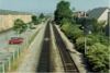
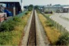
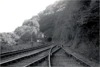
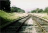
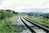
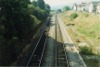 bpm00351.jpg |
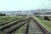
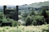
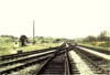
CAR | Cardiff, (Stonefield junction) & Rhymney | View from A469 road overbridge looking towards former Caerphilly West junction which took up & down line to Penrhos junction for Barry, Taffs Well or Pontypridd | Caerphilly station | 8 | 27.5 | East | ||
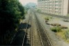
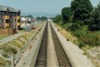
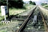
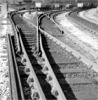
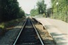 bpm00352.jpg |
CRY | Coryton | View at track level along single line towards Coryton | Tŷ Glas halt | 1 | 18 | East | ||
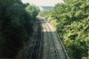
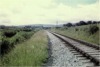
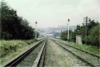
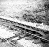
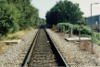 bpm00353.jpg |
CRY | Coryton | View at track level looking towards Heath area | Tŷ Glas halt | 1 | 18 | West | ||
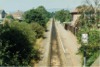
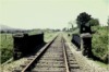
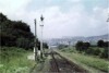
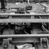
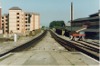 bpm00354.jpg |
CAM | Cardiff General & (Bute Road) | View from north end of platforms towards junction for Pontypridd & Rhymney lines | Queen Street station, north end | 1 | 12 | South | ||
 bpm00355.jpg |
CAR | Cardiff, (Stonefield junction) & Rhymney | View looking north from pedestrian footbridge on Rhymney branch, north of Queen station | Footbridge, north of Queen Street station | 1 | 26 | South | ||
 bpm00356.jpg |
CAR | Cardiff, (Stonefield junction) & Rhymney | View looking south from pedestrian footbridge north of Queen Street station, towards double-line junction | Footbridge, north of Queen Street station | 1 | 26 | North | ||
 bpm00357.jpg |
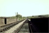
CAR | Cardiff, (Stonefield junction) & Rhymney | View from road overbridge adjacent to site of former Wernddu signal box & Caerphilly loco' works. Former Wernddu signal box stood 8 chains from camera point | West of Caerphilly tunnel, north-west end | 6 | 34 | East | ||
 bpm00358.jpg |
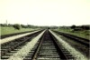
CRY | Coryton | Heath low level halt after singling of line in 1980's and as viewed from road overbridge | Heath, Low Level halt | 0 | 25 | East | ||
 bpm00359.jpg |
CRY | Coryton | View from A469 Caerphilly road overbridge looking east towards Ty Glas halt | Road overbridge, West of Tŷ Glas halt | 1 | 33 | West | ||
 bpm00360.jpg |
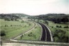
CAR | Cardiff, (Stonefield junction) & Rhymney | View of Caerphilly up & down main line with relocated Heath Low Level junction in distance (after sale of former sidings area for housing). Original junction for Whitchurch (Cardiff Railway) branch, was located at 3M-17C, i.e. at camera point which was 0M-00C Cardiff Railway datum. The new junction is at 3M-32C which equals 0M-15C and was effective from 1986 | Highbridge Road overbridge, Heath area | 3 | 17 | SE | ||
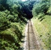
 bpm00361.jpg |
NAB | Neath Riverside & Brecon (Free Street) | The line between Cray and Dyfynog & Sennybridge stations showing abandoned permanent way in pristine condition. The line was being recovered by a contractor at time of taking | Between Cray & Defynog & Sennybridge stations | NE | ||||
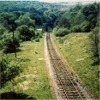
 bpm00362.jpg |
MER | Gelli Tarw junction & Merthyr | Out-of-use track at rail overbridge over minor road west of Llwydcoed. This bridge was subsequently removed and a footway now exists to the rear of the camera point and leads to Abernant and beyond, to the south-west portal of the Merthyr tunnel. The new road overbridge for the Heads of the Valleys road (A465) can be seen in the distance | East of Gelli Tarw junction | ~0 | 40 | NE | ||
 bpm00363.jpg |
MER QYZ |
Gelli Tarw junction & Merthyr (left) Quakers' Yard & Merthyr (Abercanaid line) (right) | Abandoned lines west of Rhydycar signal box and junction | West of Rhydycar junction |
5 6 |
47 04 |
South | ||
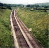
 bpm00364.jpg |
NAB | Neath Riverside & Brecon (Free Street) | Abandoned signalling, track and station at Defynog & Sennybridge. The rail bridge beyond the station became part of a road improvement scheme after 1964. A contractor was based here whilst lifting the track. | Defynog & Sennybridge station | 24 | 42 | SE | ||
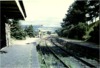
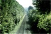
 bpm00365.jpg |
SAW | Speech House Rd & Berkeley Road | Single to double-line junction showing fouling bar & facing point lock cover. A single slip is seen at the far end of the turnout | Parkend station, south end | 12 | 18.5 | South | ||
 bpm00366.jpg |
MER QYZ |
Gelli Tarw junction & Merthyr (right) Quakers'' Yard & Merthyr (Abercanaid line) (left) | Turnout at single line junction showing fouling bar with extension to switch. The left line previously served the Abercanaid-Quakers' Yard section which was closed after subsidence in Quakers' yard No.2 viaduct was discovered. The right line served the original Vale of Neath line. | West of Rhydycar junction |
5 6 |
47 04 |
North | ||
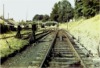
 bpm00367.jpg |
MER | Gelli Tarw junction & Merthyr | Looking towards overbridge and east end of Merthyr tunnel after abandonment of line | East side of Merthyr tunnel | 5 | 21 | North | ||
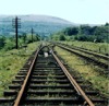
 bpm00368.jpg |
MER | Gelli Tarw junction & Merthyr | Out-of-use single line | East side of Merthyr tunnel | 4 | 74 | North | ||
 bpm00369.jpg |
MER | Gelli Tarw junction & Merthyr | Out-of-use track west of Rhydycar junction | Near Rhydycar junction | 5 | 46 | West | ||
 bpm00370.jpg |
CTD | Cadoxton South junction & Trehafod junction | Wenvoe line when still in full use and showing bullhead permanent way in excellent condition and a single tongued catch point in the up line | Vishwell road overbridge between St.Andrews & Wenvoe | 1 | 79 | South | 1959 | |
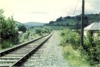
 bpm00371.jpg |
PRS | Penrhos | Looking south from a lane overbridge over the deep cutting approaching the north end of Walnut tree viaduct. The cutting was subsequently backfilled and houses built just below the road level of the overbridge | Taffs Well | 10 | ~15 | North | ||
 bpm00372.jpg |
MER | Gelli Tarw junction & Merthyr | Abandoned single line & station (This course is now a public nature trail) | Llwydcoed | 0 | 62 | East | ||
 bpm00373.jpg |
PRS | Penrhos | Aqueduct in cutting (This now lies in the abandoned cutting, immediately north of the M4 motorway) | Pentyrch bank | South | ||||
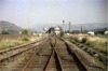
 bpm00374.jpg |
Cardiff (Bute Road) & Merthyr | Trailing crossover just south-east of Brandy Bridge, showing fouling bar & part of facing points in up main | Brandy Bridge junction, Merthyr |
23 0 |
62 00 |
NW | 1960 | ||
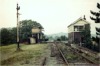
 bpm00375.jpg |
CAM | Cardiff (Bute Road) & Merthyr | General view of signal box & junction | Brandy Bridge junction, Merthyr |
23 0 |
62 00 |
South | 1960 | |
 bpm00376.jpg |
CAP | Caerphilly & Pontypridd | Single line & new up distant signal soon after the recovery of down line (Now part of the Taff Trail) | Unclassified road overbridge just east of former Nantgarw High Level halt | 10 | 29 | NW | 1960 | |
 bpm00377.jpg |
PRS | Penrhos | Walnut Tree Tunnel interior view looking towards north portal at Walnut Tree West (Black & white record) | Walnut Tree West | 9 | 30 | South | ||
 bpm00378.jpg |
PRS | Penrhos | Walnut Tree West signal box and tunnel (black & white). Note the compulsory facing point lock cover in the siding connection, since this line occasionally carried passenger (excursion) traffic | Walnut Tree West | 9 | 44 | North | ||
 bpm00379.jpg |
MER | Gelli Tarw junction & Merthyr | Sand drag facing-point & fouling bar detail in closed line | Near Merthyr tunnel (East side) | 5 | 28 | West | ||
 bpm00380.jpg |
MER QYZ |
Gelli Tarw junction & Merthyr (right) Quakers' Yard & Merthyr (Abercanaid line) (left) | Sand drag and former inner home signals in closed lines | Convergence of Quakers� Yard-Merthyr Branch with Merthyr-Gelli Tarw Branch | 5 | 38 | West | ||
 bpm00381.jpg |
MER | Gelli Tarw junction & Merthyr | Sand drag and outer home signal in closed line. The branch from Quakers Yard via Abervanaid is seen diverging on the right | Convergence of Quakers� Yard-Merthyr Branch with Merthyr-Gelli Tarw Branch | 5 | 27.5 | West | ||
 bpm00382.jpg |
Spare | ||||||||
 bpm00383.jpg |
MLT | Cambrian | View of level crossing & Wellfield Siding (for local milk processing establishment) after closure of line | Builth Wells station, west side | 86 | 49.25 | West | 15-Sep-63 | |
 bpm00384.jpg |
ROS | Ross-on-Wye & Little Mill junction | Usk signal box and closed branch | Usk station | 25 | 17 | NE | ||
 bpm00385.jpg |
NAB | Neath Riverside & Brecon (Free Street) | Out-of-use single line. The line was in the hands of a track recovery contractor at time of photograph | South of Defynog & Sennybridge station | 24 | 22 | NW | ||
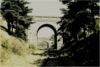
 bpm00386.jpg |
PRS | Penrhos | Remaining piers of 385-yard Llanbradach viaduct, part of the former Barry Railway and closed in 1926 & demolished in 1939 | South of former Barry junction on Bassaleg junction-Rhymney line | 15 | 20 | North | ||
 bpm00387.jpg |
Spare | ||||||||
 bpm00388.jpg |
CTD | Cadoxton South junction & Trehafod junction | View of abandoned double track on Saint Fagans viaduct, looking towards Ely viaduct & Drope junction | Ely viaduct west of Saint Fagans | 5 | 13 | North | ||
 bpm00389.jpg |
CTD | Cadoxton South junction & Trehafod junction | View of main & relief lines after abandonment | Tynycaeau | 5 | 46 | NW | ||
 bpm00390.jpg |
CTD | Cadoxton South junction & Trehafod junction | Tynycaeau junction & demolished signal box after closure of branch | Tynycaeau junction. See 00176 |
5 0 |
50 02 |
SE | ||
 bpm00391.jpg |
SFA | St.Fagans | View of arch of Saint Fagans viaduct carrying former Wenvoe branch (CTD) as seen from Saint Fagans single line branch. The Culverhouse cross-M4 link road has now replaced this structure. | Below & to west of St.Fagans viaduct | 0 | 53.5 | West | ||
 bpm00392.jpg |
NAB | Neath Riverside & Brecon (Free Street) | View of single line before A40T road realignment onto track bed centreline | A40T East of Sennybridge | NE | Aug-63 | |||
 bpm00393.jpg |
CTD | Cadoxton South junction & Trehafod junction | View of Drope road overbridge from abandoned branch. A new higher, wide-span concrete bridge now passes across this site since this is now the Culverhouse Cross-M4 Motorway dual carriageway link | Just south of Drope junction | 4 | 52 | SE | ||
 bpm00394.jpg |
NAB | Neath Riverside & Brecon (Free Street) | Abandoned single line showing then recently-performed substitution of concrete sleepers for wooden ones | Between Cray & Defynog & Sennybridge | ~21 | South | |||
 bpm00395.jpg |
BAL | Bridgend & Abergwynfi | Single blade catch points from siding fan and Glyncorrwg line at approach to Cymmer tunnel (Black & white) | Near Cymmer tunnel mouth | 11 | 11.5 | South | ||
 bpm00396.jpg |
BAP | Bargoed & Pant | Facing point lock guard showing long fouling bar, at single line junction (Black & white record) | Dowlais Top station loop junction | 25 | 54 | West | ||
 bpm00397.jpg |
BND | Brecon & Dowlais | Facing point lock & detection, close-coupled to signal (Black & white record) | Ponsticill junction | ~17 | 36 | East | ||
 bpm00398.jpg |
LTO | Llantrisant No.1 (Waterhall) | Fixed distant signal on disused branch (Line temporarily reinstated to Creigiau Quarry in 1964, after closure of line from Waterhall junction to Quarry) (Black & white record) | Approaching Common Branch junction from the Waterhall-Creigiau extension | ~9 | 60 | SE | 1959 | |
 bpm00399.jpg |
PRS | Penrhos | Single ground disc used in conjunction with traps from siding at yard top end | Penrhos yard | ~12 | 28 | SE | ||
 bpm00400.jpg |
SFA | St.Fagans | Single to double line junction when still in use for passenger traffic between Cardiff Clarence Rd & Pontypridd via Creigiau & St.Fagans | Approaching Tynycaeau junction | 0 | 10 | North | 1960 | |
| 301-350 <- |
Photos 351-400 |
-> 401-450 | |||||||
|
Date Last Revised:November 30, 2009 |
|||||||||